Drivers have mapped more than 100 TraffiTech-GH speed cameras across Accra and Kumasi using the Glydr app, following the introduction of the country's automated traffic enforcement system on November 1, 2026.
The crowd-sourcing exercise began on the day the system went live, with motorists initially sharing camera reports through Waze. A separate group later used the Roam feature on Glydr, a Ghanaian driving and carpooling app developed by RoamLabs Technology Ltd, to systematically record camera locations and speed limit signs.
According to the mapping group, more than 100 speed cameras and over 200 speed limit signs had been recorded while covering less than 30 per cent of Accra and Kumasi.
The Glydr Roam feature requires two vehicles to independently report a camera before its location becomes visible to other users. This approach is intended to reduce inaccurate reports and improve the reliability of the shared information.
TraffiTech-GH Camera Locations Reported in Accra
The reported camera locations cover several parts of Accra, with the highest concentration appearing along the northern corridor.
Drivers have identified camera locations stretching from Apenkwa and Abeka through Achimota and Abelenkpe towards Taifa, Ofankor and Sowutuom.
Other reported locations include Haatso, Papao, Madina, Dzorwulu, North Dzorwulu, East Legon, Shiashie, Bawaleshie, Ogbojo and Adjiringanor.
In the central and eastern parts of the capital, cameras have also been reported along Liberation Road, Olusegun Obasanjo Highway, Cantonments Road, Ring Road, Teshie Link and the N1 Accra-Cape Coast Road near the Densu River bridge at Weija Junction.
Additional reports cover areas around Laterbiokorshie and the Star Oil filling station.
The mapping exercise has also identified different speed limit signs, including 30km/h and 50km/h signs around Pillar 2, Haatso and East Legon.
Kumasi Camera Reports Concentrated Along the N6
In Kumasi, most of the reported cameras are concentrated along the N6 Accra-Kumasi highway.
The identified locations include Bomso, Ayigya and Kentinkrono, with additional reports extending towards Nsenie and Anwiankwanta.
Other reported areas include Asokwa, Adukrom, Asokore Mampong and Ayeduase, near the Kwame Nkrumah University of Science and Technology (KNUST).
The growing number of reports suggests that drivers are gradually building a wider picture of speed enforcement locations in the Ashanti Regional capital.
Despite the growing mapping exercise, motorists cannot rely entirely on the reported locations to avoid speed enforcement.
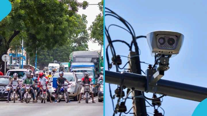
The Motor Traffic and Transport Department (MTTD) has indicated that TraffiTech-GH uses different types of enforcement equipment, including fixed cameras, mobile cameras mounted in police vehicles, tripod-mounted cameras and handheld laser speed-measuring devices.
The equipment is deployed to monitor traffic offences, particularly speeding at locations identified as prone to road crashes.
This means cameras can be moved or deployed at different locations, making crowd-sourced maps a guide rather than an official or permanent record of enforcement points.
The Ghana Police Service has also explained that images and videos captured by the system are transmitted to its back office for verification before electronic notices of violation are issued to vehicle owners.
Under the system, motorists found committing traffic offences can receive electronic notices through SMS, with details of the alleged violation.
Drivers Urged to Observe Speed Limits
Although the Glydr mapping initiative provides motorists with additional information about reported camera locations, drivers are still required to obey speed limits on all roads.
Ghana's prescribed general speed limits include 30km/h in areas such as schools, markets and other places with significant human activity, 50km/h in built-up areas, 90km/h on highways and 100km/h on motorways, subject to applicable road signs and regulations.
With more drivers contributing to the mapping exercise, the database could expand to cover additional roads and communities.
However, the mobile nature of some TraffiTech-GH enforcement equipment means that an unmapped road should never be considered free from speed monitoring.